- home

- Publication & Resources

- Blog
- Weather Station gears Uttarakhand farmers to fight climate change

Weather Station gears Uttarakhand farmers to fight climate change
BY ISHA BANERJEE
Timely and predictable disasters and natural calamities were nothing new to India’s geography. But until recently the unexpected complex nature of calamities which are driven by human factors is making it less clear on what the impacts will be or where they’ll happen or to what degree. Places which were not vulnerable to disasters are now falling in the vulnerable zones. #climate migrants are forced to flee their habitats. #climatechange crisis is for real. But taking steps locally in mitigating and adapting to the future risks of climate change. CASA Field Reporter Isha Banerjee travels across Uttarakhand to understand the global phenomenon of climate change affecting the local communities and how are they dealing with it.
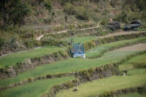
Kashmir saw unprecedented rainfalls in 2014 resulting in worst floods since 1959. The disaster nearly killed 300 people and many were left displaced out of their habitations. This was the second biggest disasters in two consecutive years after Uttarakhand floods and landslides triggered by sudden cloudburst killed nearly 5,000 people and literally devastating the state. Disasters like #floods and landslides are nothing new to the hilly terrain. But the nature of these disasters has become more frequent, more unpredictable and more untimely. Is this the effect of climate change? Why has the occurrence of floods and landslides increased in the couple of decades?
Environmental geologist K S Valdiya lives in Uttarakhand and told to Down To Earth magazine that “flash floods have little to do with geology. They are related to the rainfall pattern that has changed considerably over the years due to warming up of the atmosphere. There has been evidence that with increasing atmospheric temperature, precipitation during the rainy season is no longer uniform.” He also said that the flash floods of Uttrakashi in 2013 was “entirely man-made.”
“Historically, people avoided floodways for building houses and only did agriculture there. But decades of human activities have destroyed the geomorphic difference between floodplains and floodways. Now, there is construction work not only on floodway, but also close to the river channel. Unlike railway lines and bridges which span the floodways, roads and bridges get easily washed away because developers are least concerned about geological structures,” he said.
Post 2004 Tsunami, India became more cautious towards handling disasters as massive as this. The school curriculum started disaster awareness course – a model inspired from Japan’s government’s awareness drive on managing strong disasters like earthquakes. Is it time to not let floods and landslides catch us unaware and must be armed with knowledge to tackle such rudiments.
Residents of Tipli:
“Last time around this year, we had to cover face while stepping out of our houses because the entire surrounding region was filled with smoke. Our village in Tehri was surrounded with forest fire which had begun in February and had continued to July. Forest Fires occur mostly during February to June every year. Forest fire earlier was used to clear the field in order to harvest new crops. But it was done in a traditionally controlled way. It was a very common practice back then. But now, commercialisation of forest to extract timber has resulted in uncontrollable fires which is making it difficult for us. We have been using traditional knowledge like making a mud boundary all along the forest boundary around our village so that forest fire cannot enter our area. “Forest Fire Line” is used to prevent fire breaking into the forest from one compartment to another. The collected litter was burnt in isolation. We are also putting to use scientific knowledge like keeping the source of fire or source of ignition separated from combustible and inflammable material, and keeping the source of fire under watch and control. CASA helps us in reducing the damages caused by these forest fires.
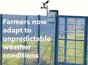
The rise in temperature and change in crop cycle was keeping the farmers in Uttarkhand in stress.
They were going through robust problems:
-Increasing incidence of climate related disasters such as flood, drought, new insects/pests, crop diseases, fire etc
-Agro-meteorological information generated in stations/research institutes and that could not reach farmers on time for their use
-to protect and enhance agricultural production and secure the livelihood of people dependent upon agriculture
-to use meteorological forecast along with other technological advancement and adapt timely mitigation process to save the crop growth
It was a small step, BUT NOW IT’S AN INTEGRAL PART
Community Based Organisations were formed and farmers from the villages who were interested to apply the scientific techniques in the fields were selected.
Weather recoding station was established and training on operating instruments. Farmers were trained in collecting agro-weather information like air temperature, RH, rain gauge, soil temperature, wind flow, direction, Soil Testing and weather recording.
Regular meetings were conducted in Climate Farmers School to discuss the local agricultural issues, and find out most possible ways for remedies and viability of the model. It aimed to disseminate climatic information to minimize the adverse impacts of flood, excess rain hailstorm and deficient rain
Established linkage of the villagers with the experts from Indian Meteorological Department and Krishi Vigyaan Bhawan (KVK).
Only one such instrument in Uttarkhand
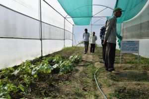
Weather recoding station was established and training on operating instruments. Farmers were trained in collecting agro-weather information like air temperature, RH, rain gauge, soil temperature, wind flow, direction, Soil Testing and weather recording.
The data is shared with experts KVK and agricultural university. They come according to their routine and crop. They take the 3 month, fortnightly data, weekly data; they tell us what to treat seeds, which seed will give more production. Example the experts gave wheat seeds and told them that this will give good production.
Earlier we used to call them. Now they visit on their own. Because of the data is available. Here they get micro level data. This is very feasible for them.
Meterogical department have also helped in this. For prediction they need 5 years of data. Now this village has 3 years of data. The Uttarakhand has not one such instrument in this village only.
Suddenly this village (Tipli) is in limelight in and around nearby 50 villages due to automatic weather station. KVK people are now frequent visitors to this village and they do demo of new agriculture techniques during showing season of each crop.
 Previous Blog Post Climate Demands Change in Homo sapiens
 Living on the edge: Children of Tea Gardens
Featured Post

International Women’s Day -2021
8 Mar 2021
International Women’s Day -2021 is very special for CASA. It’s a delight to announce, CASA with the support of the Church of Sweden has launched an exclusive Gender Desk to emphasise the importance of Gender Justice work. CASA has been working for Gender Justice all throughout and across our constituencies in all these years. Gender Desk comes to add vigour […]
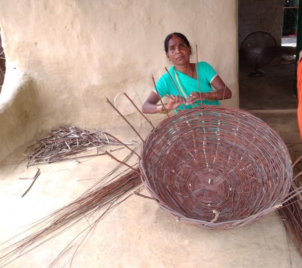
Overcoming Gender and Poverty Barriers
Poverty has been an inevitable problem in India since the beginning of time. The increasing problems of poverty caused by overpopulation and the unequal distribution of wealth among the people have led to a huge impact on the life of millions in the rural as well as the urban area. A person has to acquire […]
Impact of Climate Change on Women
16 Jan 2021
Climate change is a prevailing problem globally whose hazardous repercussions extend beyond the environment. Shrinking glaciers, extinction of plants and animal species, mutation, rise in the Earth’s average temperature and triggered seasonal fluctuations, are some of the impacts of climate change that have already grabbed the headline. Certain early predictions pertaining to climate changes had […]


